Skip to content
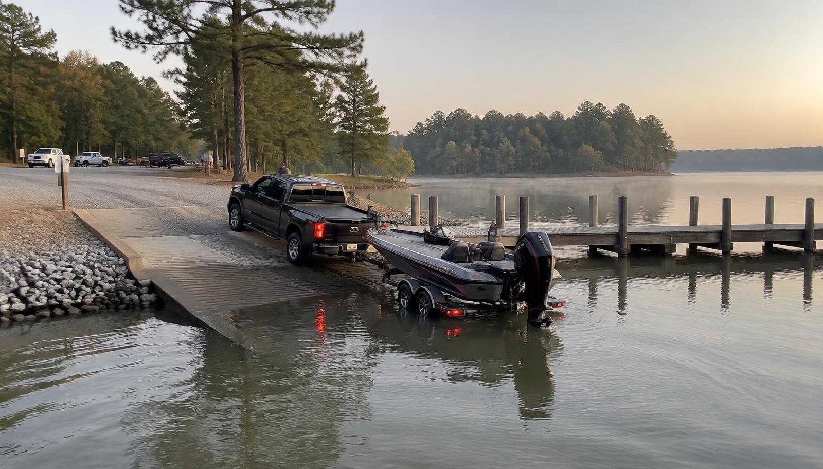
A boat being launched from a public concrete ramp on Lake Wylie at sunrise beside a courtesy dock
Public Access

Boat ramps and lake access on Lake Wylie

You do not need a dock to use this lake. Public ramps, swim beaches and paddle access sit in all three counties that touch the water.

The Short Answer

Where can the public launch a boat on Lake Wylie?

Public access on Lake Wylie is maintained jointly by Duke Energy, which holds the federal licence for the reservoir, and the counties that ring it — York County in South Carolina, Mecklenburg and Gaston in North Carolina. The South Carolina Department of Natural Resources counts five public access areas on the South Carolina side alone, with additional ramps, parks and paddle access on the Carolina shoreline to the north.

The four trailerable ramps most people use are Buster Boyd and Allison Creek in York County, South Point in Belmont, and Copperhead Island in Charlotte. Ebenezer Park in Rock Hill is the swim beach; McDowell Nature Preserve is the paddling access.

The Access Areas

Ramp by ramp

Buster Boyd Access Area

Boat ramp

Duke EnergySC-49 at the Buster Boyd bridge, York County, SC

Four lanes, roughly 112 parking spaces and a courtesy dock at the busiest crossing on the lake. It is the default launch for anyone arriving from Charlotte and the first ramp to fill on a summer Saturday morning.

Allison Creek Access Area

Boat ramp

Duke EnergyAllison Creek, York County, SC (near York/Lake Wylie, 29745)

Four lanes with about 115 parking spaces, a courtesy dock and a fishing pier. The southern-basin alternative to Buster Boyd, and generally the calmer of the two on holiday weekends.

South Point Access Park

Boat ramp

Duke Energy (Gaston County, NC)199 Boat Launch Road, Belmont, NC 28012

The largest public ramp on the lake: six paved lanes, roughly 137 parking spaces, ADA access, hand-launch area and lighting. A seasonal parking fee applies during the summer months — check current hours and rates before you tow.

Copperhead Island Access Area

Boat ramp

Mecklenburg County Park & RecreationSteele Creek, Charlotte, NC

A county boat ramp and island park on the Mecklenburg shoreline, inside the Charlotte city limits. The ramp can close when Duke Energy draws the lake down, so confirm conditions in winter and early spring.

Ebenezer Park

Park & beach

York County ParksBoatshore Road, Rock Hill, SC

The lake's principal sand swim beach, with a roped swimming area, fishing pier, picnic shelters and campground. Water quality is sampled through the Catawba Riverkeeper's Swim Guide programme during the season.

McDowell Nature Preserve

Paddle & bank access

Mecklenburg County Park & RecreationSteele Creek, Charlotte, NC

A nature preserve with canoe and kayak access, trails and a nature centre on the northern shoreline. Swimming is not permitted — this is a paddling and shoreline park rather than a beach.

Allen Fishing Access Area

Paddle & bank access

Duke Energy / Gaston County, NCUpper Lake Wylie, near Belmont, NC

A bank-fishing access point on the upper lake listed by the Lake Wylie Marine Commission. Shoreline fishing rather than a trailered launch.

Ramp fees, hours and seasonal closures change. Duke Energy publishes current lake levels and recreation information for the Catawba-Wateree chain, and each county parks department maintains its own conditions page; confirm before you tow.

How to Use Them

Launching well on a busy lake

Lake Wylie is the closest large reservoir to Charlotte, and its ramps behave accordingly. Between Memorial Day and Labor Day, Buster Boyd and South Point are typically full by mid-morning on Saturdays and again for the July 4th fireworks. Regulars launch before nine or after four and treat the middle of the day as someone else's.

Ramp etiquette on this lake is unwritten but strictly observed. Rig in the parking area, not on the ramp apron. Load and unload at the courtesy dock, then move the boat off it immediately — courtesy docks are for transfer, not for tying up while you eat. Back straight, and if you cannot, let the queue behind you help rather than making three attempts.

Water levels matter more here than on a natural lake. Duke Energy manages the pool under its federal licence, and winter drawdowns can leave shallow ramps — Copperhead Island among them — temporarily unusable. Full pond on Lake Wylie is about 569.4 feet above sea level; the utility publishes the current reading daily.
Two States, Two Rulebooks

Licences and regulations

The state line runs down the middle of Lake Wylie, and the rules change with it. Fishing requires a licence from the state whose water you are fishing — South Carolina DNR on the York County side, the North Carolina Wildlife Resources Commission on the Mecklenburg and Gaston side. Reciprocal arrangements exist on parts of the Catawba chain, but they are specific; read the current regulations rather than assuming.

Boating law, no-wake zones and enforcement are similarly split, with the Lake Wylie Marine Commission coordinating across the border. Registration follows the state where the boat is principally used. The practical version: carry the licence for both states if you fish the whole basin, and learn where the line falls in the coves you use most.

If You Would Rather Not Trailer

Public marinas on the lake

Six marinas serve the public around the basin with slips, service and, at several, fuel. They are the alternative to a ramp for anyone keeping a boat on the water rather than in a garage.

  • Lake Club Marina — Harbor Inn Road, Rock Hill, SC
  • Tega Cay Marina — Marina Drive, Tega Cay, SC
  • Pier 49 Marina — Fort Mill / Lake Wylie, SC
  • River Hills Marina — River Hills, SC
  • Harbortowne Marina — Lake Wylie, SC
  • Carolina Crossing Marina — Lake Wylie, SC