Is Lake Wylie man-made?
Yes — and it is the oldest of them all. The story of how a river became the first reservoir in the Catawba chain.
A reservoir, not a natural lake
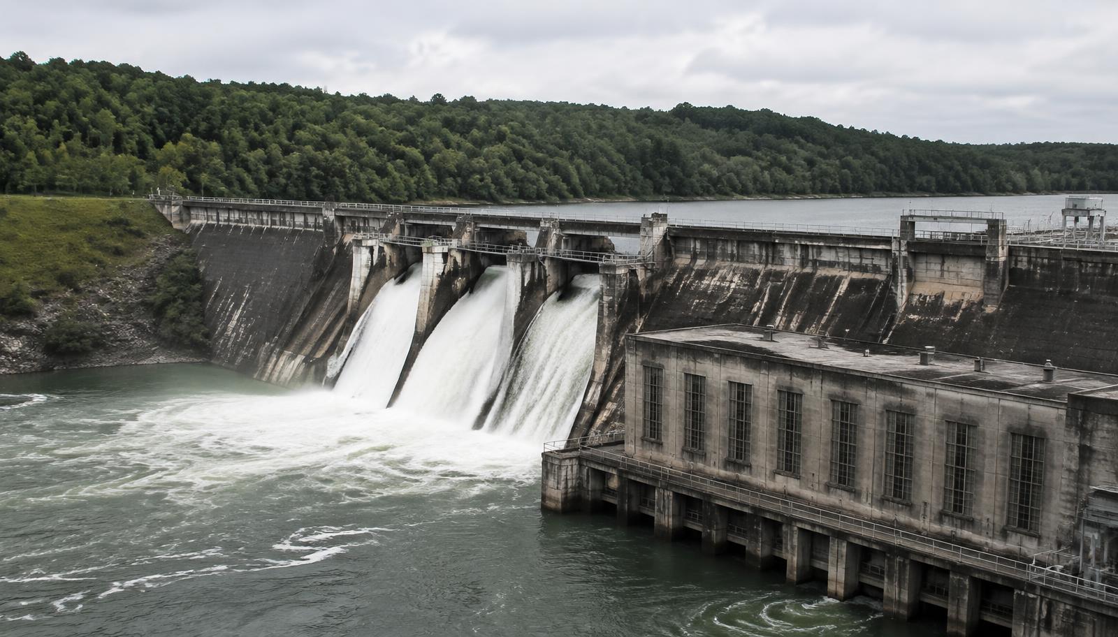
Lake Wylie is entirely man-made. It is an impoundment of the Catawba River, created by a hydroelectric dam first completed in 1904 and substantially enlarged in the mid-1920s when a larger structure — the present Wylie dam — replaced the original works. That makes it the oldest reservoir in the Catawba-Wateree chain that Duke Energy operates today.
The lake takes its name from Dr. Walker Gill Wylie, the South Carolina–born physician who, with his brother, financed and championed the early Catawba hydroelectric work that grew into the Duke Power system. The lake carried the name Catawba Lake before the Wylie name settled on it.
It sits in both states: the South Carolina shoreline lies in York County, and the North Carolina shoreline in Mecklenburg and Gaston counties. At full pond — roughly 569.4 feet above sea level — the lake covers on the order of 13,400 acres with around 325 miles of shoreline.
The river before the lake
Before the dam, this was simply the Catawba running south out of the Carolina piedmont toward the Wateree and, eventually, the Santee. It was a working river — shoals, ferries, mills, bottomland farms — and its fall through the piedmont was exactly the feature that made it valuable to a generation of engineers who had begun to understand what moving water could do to a turbine.
The idea was not merely to generate electricity but to build a system: a chain of dams that could regulate flow and supply the textile mills spreading across the two Carolinas. Lake Wylie is where that idea was first proven. The Catawba Power Company completed the original station in 1904 and began sending current to Rock Hill — an early demonstration of long-distance power transmission in the region.
What that first impoundment produced was a modest lake by today's standard. The shoreline most residents know was still two decades away.
The dam that made the lake
In the mid-1920s the original works were superseded by a larger dam and powerhouse downstream of the first station. The new structure raised the pool substantially, flooded farmland and river bottoms up the Catawba and the South Fork, and produced something much closer to the lake on today's maps: a long, branching reservoir reaching from Mountain Island Lake's tailrace in the north to the dam in the south.
The shape explains a great deal about how the lake behaves. It is a drowned river valley, not a bowl. The old channel is still the deep water; the coves are flooded creek beds; and depth at any given dock has more to do with where a tributary once ran than with how far the house sits from open water. Buyers who understand that read waterfront listings very differently from buyers who do not.
The pool has been managed on the same principle ever since. Duke Energy holds the federal licence for the reservoir, sets the target lake level seasonally, and administers everything built along the shoreline through its shoreline management programme.
From power project to place to live
For its first half-century the lake was infrastructure with recreation attached: fish camps, family cabins, church picnics, a few marinas. River Hills, begun in the early 1970s, was the first attempt to treat the shoreline as a planned residential address rather than a weekend one, and it set the pattern — gate, golf, marina, covenants — that later communities refined.
Charlotte's growth did the rest. The lake sits roughly twenty miles from Uptown, closer than any other large reservoir in the metro, and that proximity turned seasonal cottages into primary residences across the 1990s and 2000s. South Carolina's tax posture accelerated it on the York County side, where a substantial share of buyers work in North Carolina and live in South Carolina by deliberate choice.
What remains unusual about Lake Wylie is how legible its history still is. The 1904 project explains why the water is here. The 1920s dam explains the shape of every cove. Duke Energy's licence explains why your neighbour's pier took four months to approve. It is a young lake with a long memory.
Lake Wylie, answered plainly
Is Lake Wylie in North or South Carolina?
Both. The state line runs through the water. The community called Lake Wylie, SC is in York County, South Carolina; the northern and eastern shoreline lies in Mecklenburg and Gaston counties, North Carolina. Towns, counties and utilities are set out here.
How old is Lake Wylie?
The first impoundment dates to 1904, which makes the lake well over a century old and the oldest reservoir in the Catawba chain. The lake at roughly its present size dates to the mid-1920s enlargement.
Who owns and manages the water?
Duke Energy operates the reservoir under a federal licence and manages the shoreline, lake levels and dock permitting. Counties and municipalities govern the land; the Lake Wylie Marine Commission coordinates on-water matters across the state line.
Why does the lake level change?
Because it is a working reservoir. Levels move with rainfall, generation and seasonal targets, with winter drawdowns the most noticeable. Full pond is about 569.4 feet above sea level, and the utility publishes the current reading.
How big is Lake Wylie?
Roughly 13,400 acres of water and about 325 miles of shoreline, stretching some thirty miles from the upper river down to the dam — a great deal of edge for a lake of that surface area, which is why so much of it feels private.
Continue with Lake Wylie's distance from Charlotte, public boat ramps and lake access, the lake life guides, and the shoreline communities.